The Myanmar civil war is already confusing on its own, making it difficult to figure out who is fighting whom and where these skirmishes took place. For one, the dense jungle is already hard enough for fighters on both sides to navigate. Additionally, the Burmese language—unlike English—is difficult to understand. Anyway, I managed to find two separate locations where skirmishes possibly happened.
KIA attack on the SAC in Bhamo
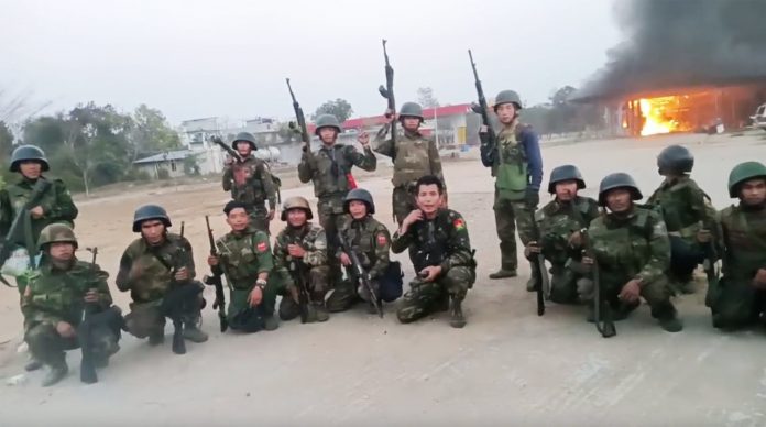
According to many sources, this attack occurred within Bhamo Airport, which is somewhat accurate. While it is true that the attack happened, the part about it being at an airport is somewhat incorrect. The attack took place on January 26, 2025, in the Bhamo region,
accompanied by this picture.
 |
Known picture of the attack
|
If you zoom into the picture, it appears to be a gas station (the one highlighted in green), with even more clues suggesting that it is a gas station, such as what seems to be a gas storage facility (highlighted in red). Googling gas stations near Bhamo Airport, there is a gas station named
Hein Aung.
 |
Proximity between Hein Aung gas-satiation and Bhamo Airport
|
Seeing pictures of it from Google Reviews, almost the same description fits while zooming into some visual clues that match the Google images provided in the picture of the assault.
 |
Similarities on the photo of the assault and pictures of the gas-station
|
Myanmar MRTV Station Battle
This one is much harder because there is no known location for this particular MRTV station on Google Maps. There are many of these stations, and I’m guessing this could be one of the repeater stations that simply rebroadcast what the main station does.
Several sources suggest that it is in Monywa, but I think it happened on the outskirts.
 |
Satellite dishes (green) and Radio Towers (red)
|
These are the two known photos of the attack. Several visual indicators can be seen here—one is the satellites, and the other is the large communication or radio tower beside it. It is difficult to decipher the sign in the other picture, even if someone translates it manually instead of using an OCR machine. The text is highly compressed, making it hard to read.
One key clue that people might have overlooked is the presence of what appears to be Buddhist temple towers or the top of a Buddhist temple behind the radio equipment.
 |
| What appears to be a Buddhist temple in the background. |
|
|
Now, having these visual clues isn’t really useful if you don’t have additional information on hand. I don’t want to spend eight hours staring at the entirety of Monywa City or the whole Sagaing Region searching for this location. However, we got lucky—since this is a radio broadcast site, there should be an online directory of radio stations in Southeast Asia. Fortunately, I found a website called AsiaWaves, which catalogs a handful of radio stations and, to some extent, repeater stations across Asia.
Of course, we checked the location, but there are no available Google Maps images or any notable business landmarks, except for the gas station. This place allegedly also doubles as a military outpost.
 |
Radio tower (red), Satellite Dish (green), Buddhist Temple (purple)
|
I don't know if this location is accurate or if most radio broadcast centers in Myanmar are designed in the same way. It's also possible that there's another broadcast center in the region that I forgot or overlooked.
I still don’t know if these locations are accurate. Someone more familiar with the area, more knowledgeable than me, or better educated in Myanmar’s geography could probably confirm their accuracy.


Comments
Post a Comment